Although it can be confused with several other brown farmland birds, the corn bunting likes to make its presence obvious! Males sit and deliver their loud ‘jangling keys’ call from atop bushes, tree-tops and fence posts and appear as a fat brown streaky-chested bird with a thick bill, a little chubbier than a yellowhammer. To identify numbers of singing male territories:
- You’ll need an Ordnance Survey grid map, farm field map, and binoculars. Learn the corn bunting’s ‘jangling keys’ song! (www.british-birdsongs.uk/uk/corn-bunting/)
- To survey a landscape-scale area, it’s best to design permanent transects that you walk twice annually: once in May and once in June.
- Using the Ordnance Survey 1km grid, select alternate squares and identify two 1-km routes running roughly north-south or east-west within each square.
- Choose a sunny early morning with little wind, and record the date and time. Walk the transects at a steady pace, stopping to scan prominent places ahead with the binoculars and listening. Note down the male territories on the map.
- For a smaller farm, walk the whole area listening/watching for male corn buntings. You can sometimes cover a large area (>10ha) of open farmland by observing from one point at a time, as the males tend to make themselves obvious!
- Use the maximum number of singing males across the two visits as the measure of breeding territories. Repeat surveys every year, to identify areas of high and low density and monitor numbers of territories. Target management accordingly.
Multiple species transects: if you have waders/yellowhammers on your cluster priority list, you could survey them at the same time.
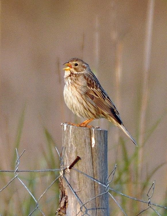
Male corn bunting singing from a prominent perch © Peter Thompson GWCT